

— Photo by Lawrence Sherwin ©
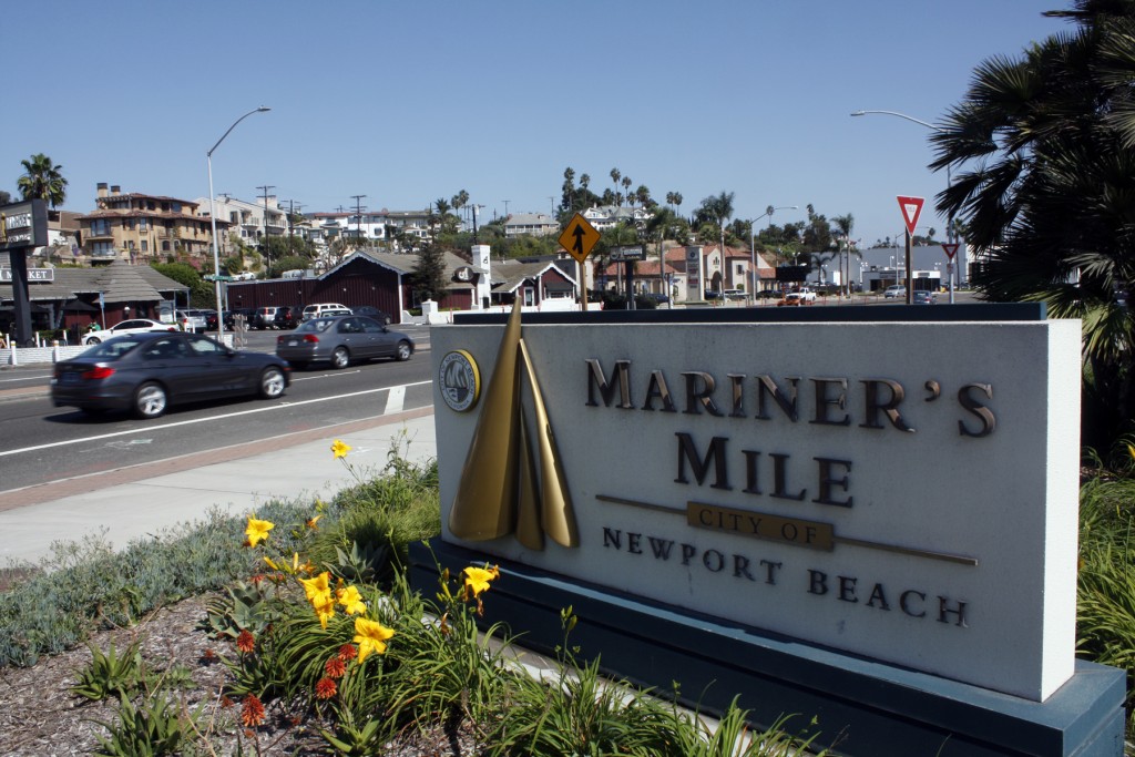
Traffic along Pacific Coast Highway, specifically in Mariner’s Mile, was discussed in depth Newport Beach City Council members, city staff, and county transportation officials.
During the Council’s study session on Tuesday, the Orange County Transportation Authority gave a presentation of their recent Pacific Coast Highway Corridor Study, and in another item, city staff discussed traffic capacity and land use issues along Mariner’s Mile.
At the regular meeting later that night, Council unanimously approved a $206,922 contract with PlaceWorks to develop a Revitalization Master Plan for Mariner’s Mile. Councilman Marshall “Duffy” Duffield recused himself from the vote because he owns a business in the area.
The master plan will evaluate existing land use policies and regulations which may inhibit revitalization of the area. The project scope to develop the plan will include public engagement, evaluating existing policies and regulations, parking management, pedestrian and bike connections, public meetings, and more. Work on the plan is scheduled for June through December.
At the study session, staff from OCTA presented their analysis and findings from a comprehensive study of mobility along PCH between Seal Beach and San Clemente. The study was conducted in 2014 and 2015 along the 37-mile corridor. The goal of the study was to identify a broad range of long-range multi-modal strategies to improve traffic flow and improve safety and mobility,
There was a lot of collaborative work between the cities to bring this issue to the attention of OCTA, said Councilman Tony Petros.
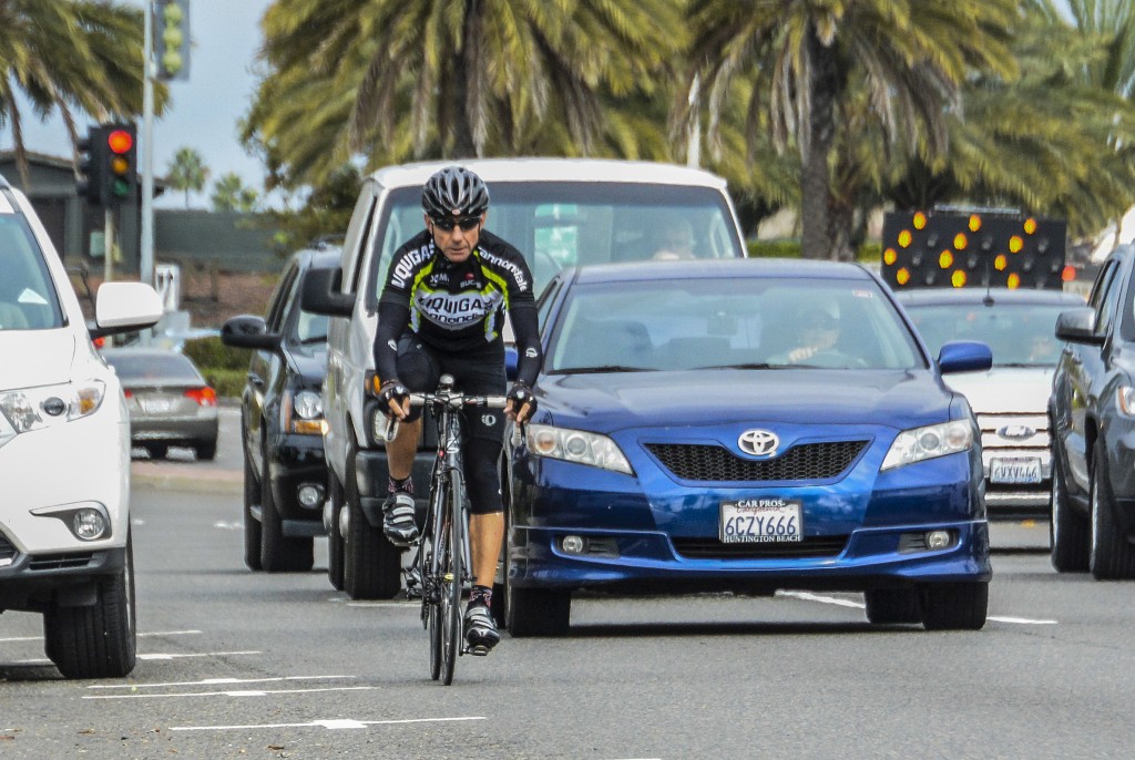
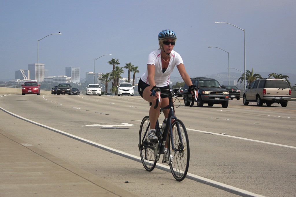
“This has got to be one of the first collaborative efforts that started from the ground up that was facilitated, successfully, by OCTA,” said Petros, an avid cyclist. “I’m very interested in what the findings say and the fact that we’re now starting to really have a good conversation about multi-modalism.”
He often rides along PCH and there are a number of places that need more attention, Petros noted.
— Photo by Sara Hall ©
Joseph Alcock, OCTA section manager, said they identified 37 specific improvements for Newport Beach to consider implementing over time, as funding and resources become available.
“The study is a long-term vision document,” Alcock said
For Newport Beach specifically, some of the key problems identified in the study include bicyclists face potential conflicts when traveling between parked cars and moving vehicles, heavy volumes of pedestrians, bicycles, and traffic aggravate conflict potential, and delays due to signal timing not being optimized for continuous traffic flow.
They came up with several options, studied each, compared the cost and benefits, and narrowed them down into three recommended alternatives ranging in cost and complexity. They worked example needs/issues through each of the three plans and compared solutions.
OCTA is currently conducting outreach with all of the cities within the corridor. They anticipate that the study’s findings will be incorporated by Caltrans, OCTA and Southern California Association of Governments in the long-range planning documents
They will also likely be used by the lead agencies, like the city of Newport Beach or Caltrans, to start applying for competitive funds to start project development activities.
The report identifies several potential (depending on the eligibility requirements) funding sources, Alcock noted, like the Highway Safety Improvement Program and the Bicycle Improvement Program Call for Projects.
“Being in a planning document that is consensus-based helps you in your grant application process,” Alcock noted.
Another positive aspect about working with OCTA and Caltrans in is that the study also helped “solidify” some things the city believes they can do, but the rules and regulations have hindered their efforts, pointed out Public Works Director Dave Webb. The plan may offer some new design solutions, he added.
Webb also discussed traffic capacity and land use issues along Mariner’s Mile during the study session. Duffield recused himself from the discussion because he owns a business in the area.
— NB Indy file photo ©
The stretch of West Coast Highway between Dover Drive and Newport Boulevard, called Mariner’s Mile, varies in lanes, speed, and structure. Land uses along Mariner’s Mile are in part tied to West Coast Highway, in that the ultimate width of the highway may determine which land uses work best. City Public Works staff asked for council and community feedback on the width and land configurations for the future of Mariner’s Mile.
There have been a lot of complaints from residents over the years about traffic in the area, Webb noted. The bicycling community really want safe, clear lanes in this section of PCH, he added.
Webb went over a few different configurations that address capacity needs through Mariner’s Mile, including keeping the minimum right-of-way width of 128 feet, or a six lane “hybrid.”
A few members of the public were hesitant to support the ideas presented and raised a few concerns.
The plan will basically build a “super highway” in Mariner’s Mile, and by doing that “you can basically kiss goodbye any viable retail opportunities in that whole area,” said one resident and business owner. Speeding things up will not help revitalize the area, he added.
Another local noted that several proposed development projects in the works will only make the traffic problem worse. It’s an insult to say otherwise, she said.
Several council members emphasized the importance of working with the local business owners on the plan.
Council gave staff some direction on how to move forward.
Staff will look into a plan that would remove the remaining on-street parking and construct a class II on-street bike lanes and consider possibly relocating public street parking to on-site lots.
They were also directed to undertake a land use study to review and recommend possible land use and zoning modification for the Mariner’s Mile business areas to assist with property redevelopment and revitalization in conjunction with ultimate roadway widening and improvements.
City staff will also work with Caltrans to possibly use a modified (reduced) major arterial typical cross-section for right-of-way and roadway design (112 feet rather than 128 feet).
Council would need to vote on any configuration plan before it is implemented.
For more information, visit newportbeachca.gov. OCTA’s PCH corridor report can be viewed at octa.net/pdf/OCTA_PCH_Corridor_Study.pdf


