

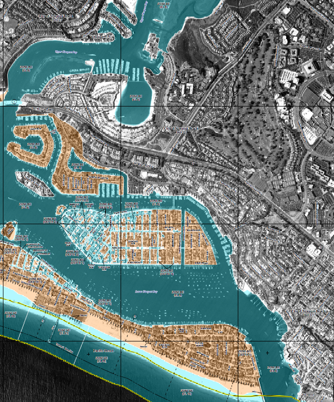
— Courtesy city of Newport Beach
The Newport Beach City Council will hold a study session about the updated flood map next week.
City staff will share the revised Federal Emergency Management Agency flood map with Council and the public during a study session at 4 p.m. Tuesday in Council chambers.
The revision is “the result of staff’s two-year effort in working with FEMA to update the preliminary flood maps,” officials wrote in a message Tuesday.
There are significant changes to FEMA’s preliminary maps, originally published in early 2016.
“The new maps have greatly diminished the number of properties subject to flood insurance, but some properties will remain or will be added to the flood zone. Properties affected are located on Balboa Peninsula (both on the harbor side and open coast side), Balboa Island, and Bay Island.,” the message reads.
Comments on the new maps can be submitted no later than July 16 to Chief Building Official Samir Ghosn. Comments can be emailed to CDD@newportbeachca.gov or mailed to City of Newport Beach, Community Development Department, Attention: Samir Ghosn, 100 Civic Center Drive, Newport Beach, CA 92660.
For more information, visit newportbeachca.gov/fema.


